Attachment B: Work Group Schedule
Attachment C: Fact Sheet Meeting 1-6, (7 MB, PDF, 20-30 minute download on dialup. If you have questions call Kathy Sherer, 970-884-2355)
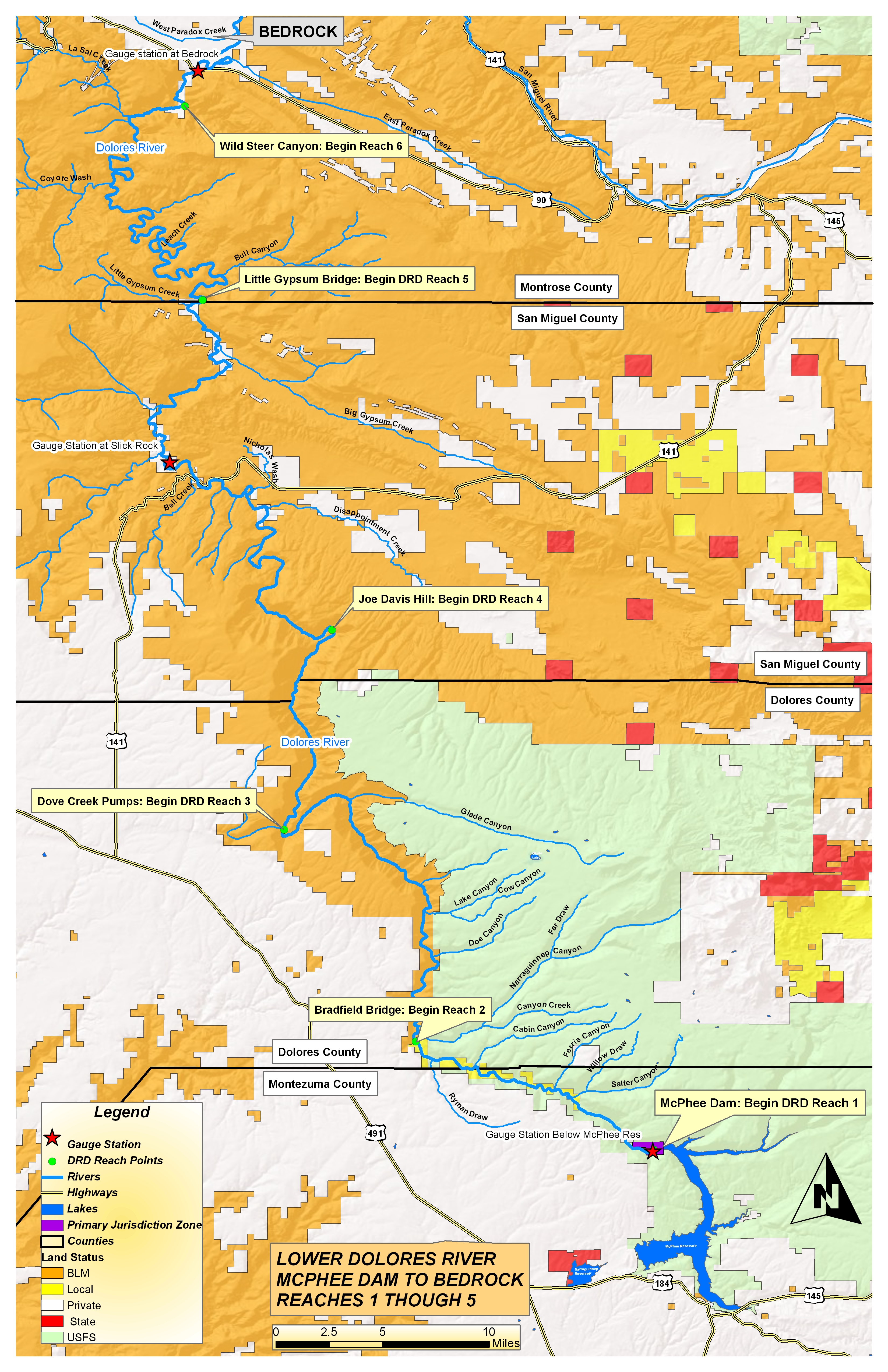
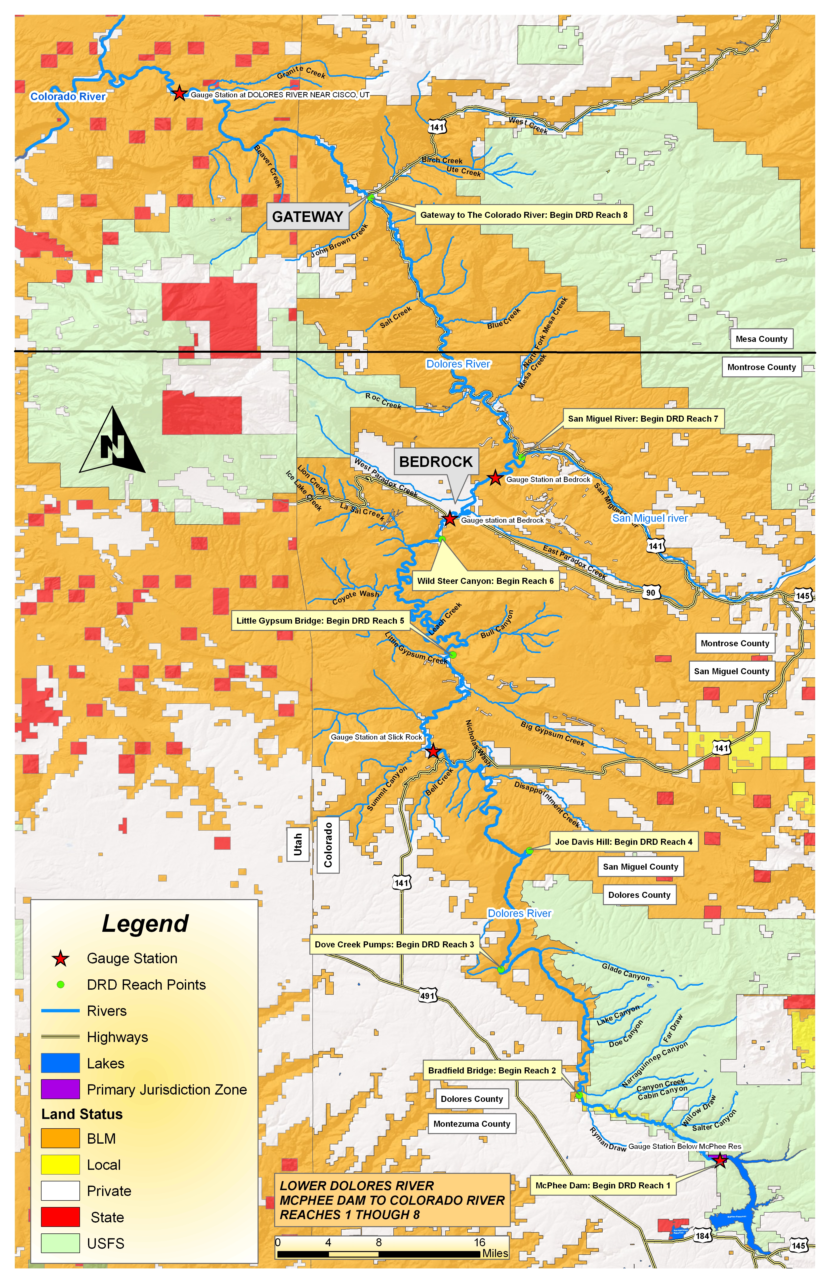
Attachment D: Reach Map (PDF, 723 KB, 3-4 minute download on dialup. If you have questions call Kathy Sherer, 970-884-2355)
Attachment E: Field Trips, (PDF, 4 MB, 12-16 minute download on dialup. If you have questions call Kathy Sherer, 970-884-2355)
Attachment F: Narrative Reaches 3 and 4
Attachment G: Reach 3-4 Maps (PDF, 4.6 MB, 13-17 minute download on dialup. If you have questions call Kathy Sherer, 970-884-2355)
Attachment H: ORVs
Attachment I: Small Group Exercise
Attachment J: Information Grid
Attachment K: Process Flow Chart
Attachment L: DRD Technical Committee 8-5-09
Attachment M: Spill
Attachment N: Review Field Science Questions(PDF, 11 MB, 30-45 minute download on dialup. If you have questions call Kathy Sherer, 970-884-2355)
Attachment O: Native Riparian Research